
Copyright © RASModel.com. 2013. All rights reserved.
What are the implications of having a cross section that is too short and doesn't extend all the way out to the highest computed water surface elevation? Does it affect the results? Take this cross section for example. It is missing much of the left overbank (presumably).
First of all, when RAS encounters this situation, it will automatically extend the last station elevation point vertically to the height of the computed water surface. This adds a so-called "vertical wall" to the end of the cross section. Additional wetted perimeter will be included for water that comes into contact with the "vertical wall".
So what does this mean? Well, you will be missing out on wetted area-possibly a LOT of wetted area. Maybe it's negligible. It's up to you to decide. For typical rivers, the added wetted perimeter associated with the "vertical wall" will not make much of a difference in the results. If you plan on mapping the computed flood plain in RAS Mapper, or in GIS using the GeoRAS extension, you'll miss out on some areas that should be shown as inundated.
I see a few possible scenarios that you would need to consider. Your course of action will depend on whether your model is steady or unsteady, and how much error you're willing to accept at this location:
1. The missing wetted area is actually very small. Either the maximum water surface elevation just exceeds the end point or perhaps there is a bluff just to the left of the first station elevation point that would contain all of the water. In this case, you probably don't waste time getting additional survey data and leave the cross section as is, or you manually approximate in a station elevation point to capture the bluff.
2. There is considerable flow area that is missing, but it is so far out in the overbank or it's in a flow separation area and it can all be considered ineffective. In a steady flow model, you can probably leave this as is. Ineffective flow area is ignored in steady flow computations. The answer will be slightly different if you extended the cross section and put in an ineffective flow trigger. This is strictly due to the difference in quantified wetted perimeter. For typical rivers, where the width is much greater than the depth, this will make little difference in your results. For unsteady flow, there could potentially be a huge error in the results if you leave the cross section as is. In unsteady flow modeling, ineffective flow areas are accounted for as hydraulic storage in HEC-RAS. Hydraulic storage will attenuate the flood wave as it progresses through a system. Omitting available storage can significantly affect both the propagation and attenuation of your flood wave. I strongly recommend extending the cross section to high ground in this case.
3. There is considerable flow area that is missing, and it is actively conveying flow. In this case, steady, or unsteady, you'll want to extend the cross section to high ground. Omitting this portion of your cross section will have a direct impact on the computed water surface elevation. The degree to which depends on how much of the cross section area you are omitting, but it could be quite significant.
So...how do we extend the cross sections? In a perfect world, you'd have your survey crew go out and get you more points. Unfortunately this cost money and takes time, frequently both of which you don't have an excess of when doing a hydraulic model study. If your RAS geometry is already set up in GIS and your terrain model extends far enough laterally, you could simply extend the cross section cut line to the high ground and reimport into RAS. Easy!
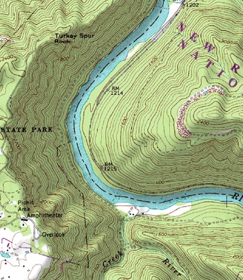 However, if you do not have a georeferenced model and you can't get your survey crew out to the field in a timely (and cost-effective) manner, you can always approximate the extension of your cross sections using a USGS topo map.
These "Quad" maps can be found for free on-line for any location in the US. In fact, there are similar topography data sets for just about the entire world-available on-line for free. The downside is that their resolution is quite inadequte for typical river modeling, and they don't include bathymetry (underwater topography). However, for the purposes of extending your cross section to high ground, this can be an acceptable alternative to a physical survey.
Simply find and download a terrain map that covers your area of concern. Locate your existing cross section line on that map. Then extend it to high ground, marking the locations where your cross section line crosses contour lines. Note the elevations, and the relative distances between contours, then manually enter that data as new station elevation points.
What are the implications of having a cross section that is too short and doesn't extend all the way out to the highest computed water surface elevation? Does it affect the results? Take this cross section for example. It is missing much of the left overbank (presumably).
 |
| Image courtesy of Adam Bohnoff |
First of all, when RAS encounters this situation, it will automatically extend the last station elevation point vertically to the height of the computed water surface. This adds a so-called "vertical wall" to the end of the cross section. Additional wetted perimeter will be included for water that comes into contact with the "vertical wall".
So what does this mean? Well, you will be missing out on wetted area-possibly a LOT of wetted area. Maybe it's negligible. It's up to you to decide. For typical rivers, the added wetted perimeter associated with the "vertical wall" will not make much of a difference in the results. If you plan on mapping the computed flood plain in RAS Mapper, or in GIS using the GeoRAS extension, you'll miss out on some areas that should be shown as inundated.
I see a few possible scenarios that you would need to consider. Your course of action will depend on whether your model is steady or unsteady, and how much error you're willing to accept at this location:
1. The missing wetted area is actually very small. Either the maximum water surface elevation just exceeds the end point or perhaps there is a bluff just to the left of the first station elevation point that would contain all of the water. In this case, you probably don't waste time getting additional survey data and leave the cross section as is, or you manually approximate in a station elevation point to capture the bluff.
2. There is considerable flow area that is missing, but it is so far out in the overbank or it's in a flow separation area and it can all be considered ineffective. In a steady flow model, you can probably leave this as is. Ineffective flow area is ignored in steady flow computations. The answer will be slightly different if you extended the cross section and put in an ineffective flow trigger. This is strictly due to the difference in quantified wetted perimeter. For typical rivers, where the width is much greater than the depth, this will make little difference in your results. For unsteady flow, there could potentially be a huge error in the results if you leave the cross section as is. In unsteady flow modeling, ineffective flow areas are accounted for as hydraulic storage in HEC-RAS. Hydraulic storage will attenuate the flood wave as it progresses through a system. Omitting available storage can significantly affect both the propagation and attenuation of your flood wave. I strongly recommend extending the cross section to high ground in this case.
 |
| For steady flow, the differences in RAS will be very slight between these two options, limited to the wetted perimeter computed added at the vertical wall (ineffective flow assumes a frictionless boundary). In unsteady flow, these two options could produce VERY different results. |
3. There is considerable flow area that is missing, and it is actively conveying flow. In this case, steady, or unsteady, you'll want to extend the cross section to high ground. Omitting this portion of your cross section will have a direct impact on the computed water surface elevation. The degree to which depends on how much of the cross section area you are omitting, but it could be quite significant.
So...how do we extend the cross sections? In a perfect world, you'd have your survey crew go out and get you more points. Unfortunately this cost money and takes time, frequently both of which you don't have an excess of when doing a hydraulic model study. If your RAS geometry is already set up in GIS and your terrain model extends far enough laterally, you could simply extend the cross section cut line to the high ground and reimport into RAS. Easy!
 However, if you do not have a georeferenced model and you can't get your survey crew out to the field in a timely (and cost-effective) manner, you can always approximate the extension of your cross sections using a USGS topo map.
 These "Quad" maps can be found for free on-line for any location in the US. In fact, there are similar topography data sets for just about the entire world-available on-line for free. The downside is that their resolution is quite inadequte for typical river modeling, and they don't include bathymetry (underwater topography). However, for the purposes of extending your cross section to high ground, this can be an acceptable alternative to a physical survey.
Simply find and download a terrain map that covers your area of concern. Locate your existing cross section line on that map. Then extend it to high ground, marking the locations where your cross section line crosses contour lines. Note the elevations, and the relative distances between contours, then manually enter that data as new station elevation points.


